Thursday, 4 September 2014

Mull of Kintyre and Campbeltown : August 4th, 5th, & 6th


The passage from Port Ellen to Campbeltown was more of an undertaking than most of our recent days, with a distance of about 45NM and the rounding of another major tidal gate in the Mull of Kintyre. The wind was variable through the day with good stints of sailing indispersed with periods of motor sailing. The views from the boat were spectacular with the ever present Kintyre peninsular looming ahead, Islay receding behind, and to the south, Raithlin Island, the northern coast of northern Ireland, and the Galloway coat to the south east. Although we did see a little broken water in places our passage was uneventful, with a significant acceleration as we navigated around the Mull headed into Sanday Sound between Kintyre and Sanday Island. Maximum observed speed over the ground was 8.6Kts.

Rounding the Mull of Kintyre

Sanday Island.

Looking west towards the Mull from Sanday Sound.

As we turned North towards Campbeltown the wind dropped, but with the assistance of the engine we maintained a speed of 7Kts or so. As we approached Cambeltown, Island Davaar came into view, this has a covering shingle spit which connects the island to the land preventing what would be a tempting shortcut!

Island Davaar, the shingle spit is to the left of the island.

A short while later we were tied up safely to the long leisure boat pontoon next to the harbour.

The pontoon at Campbeltown, 'NJ' on the outer end.

We were pleasantly surprised by Cambeltown, with it's sturdy pontoon, a good supermarket near by, and many impressive buildings including the Royal Hotel where the pontoon dues were collected. We will be interested to see what transpires over the winter as a major expansion of the yacht facilities is planned, with the existing pontoon being removed in November.

The Royal Hotel, one of many impressive buildings.

We made up for our premature depature from Port Ellen with a three night stay in Cambeltown which we thoroughly enjoyed.

Islay Sound and Port Ellen

The anchor was raised at 09-05, after a comfortable night despite the near gale, and by 09-45 we had cleared the entrance to Loch Tarbert having taken advantage of the much improved weather to take several photo's.

The boats log records the wind as a 'flat calm' which surprised us after the howler the night before! As we entered Islay Sound the boat accelerated steadily, reaching a maximum over the ground of 9.3Kts.

The 'Paps of Jura' from Islay Sound.

Islay seems to be the epicentre of whiskey distilling, as we passed through the sound, and then south to Port Ellen we noted at least six distilleries proudly displaying their names on the seaward facing walls.

Bunnahabhain Distillery in Islay Sound.

When we arrived at Port Ellen, the small marina was full, so we headed over to the other side of the bay, and anchored off the beach - one of the interesting aspects of this area is the very small tidal range ( LW 0.4m, HW 0.8m for the day ) which makes anchoring very easy.

Anchored off the beach.

Port Ellen Harbour from the anchorage.

The intention had been to spend a couple of days at Port Ellen, but with 'no room at the Inn' and the tide fair to round the Mull of Kintyre the next day we decided to note Islay for a future visit, and head off to Campbeltown on the east facing side of the Kintyre peninsular.

Sunday, 10 August 2014

The Sound of Iona and Loch Tarbert, Isle of Jura.

Leaving Bunnessan at 09-00 put us in a good position to catch the start of the fair tide through the Sound of Iona. There was very little wind, so we were motoring with the main up.

The entrance to Iona Sound.

As we passed over a shallow area in the sound we disturbed a flock of cormorants which were busy fishing. The sound was very picturesque, and we had good views of Iona Cathedral and Martyrs Bay village.

Iona Cathedral.

Martyrs Bay Village.

By 11-00 we were through the sound and heading to pass to the north of Colonsay before turning south to Loch Tarbert on Jura. At 12-00 the wind picked up allowing us to have a good sail.

Two hours later the rain started, just as we approached the entrance to Loch Tarbert. We took the sails down in good time to pick up the leading line to take us to the north of Boghachan Baite and Sgeirean Bhudragain. Meanwhile the wind was increasing and the rain heavier and heavier! Our first attempt to anchor was to the west of Cumhann Mor but with another yacht in residence we felt that we were too close to some rocks.

We decided to try our luck further east in the inner loch. In the driving rain Sue was on the helm, steering using the chart plotter whilst I was peering into the rain over the spray hood to make sure that we safely negotiated the channel at Cumhaan Mor between the outer and inner loch.

We attempted to anchor for the second time just to the east of Cunhann Mor but abandoned this after dragging. Third time lucky, at 16-05, we anchored off the north shore of the loch, south of Cruib Lodge on a gently shelving bottom. We were glad we had taken the trouble to find a good anchorage as at 16-00, Belfast coastguard issued a gale warning for Malin and Hebrides sea areas! Despite noting winds up to 30Kts the anchor held fast and we had a good night lying to the northerly wind.

Next morning the gale had blown through leaving a bright and pleasant day for us to appreciate the fine scenery of the loch as we departed to head further south.

Anchorage to the south of Cruib Lodge. 

The Cumhann Mor narrows. 

One of the Paps of Jura. 

Raised beaches on the shore of Loch Tarbert.

Treshnish Isles, Staffa, and Bunnessan.

Having visited all the Small Isles we headed south from Eigg, with an overnight stop at Coll. On our way to Arinagour on Coll we spotted several basking sharks. On approaching Arinagour we had a close encounter as Sue had to make a rapid change in course and take the engine out of gear when she saw a shark very close to the bow of the boat.

From Coll our course to Bunnessan on the Ross of Mull took us directly through the Treshnish Isles and past Fingals Cave on Staffa. We would have liked to have had an overnight stop in the Treshnish Isles but the outlook forecast was for N or NW 5 to 7.

Approaching the Treshnish Isles.

Careful Navigation was required to negotiate the channel, taking us alarmngly close to the rocks of Sgeir Eirionnaich.

Our track through the Treshnish Isles.

Passing close to Sgeir Eirionnaich.

In the channel the wind increased and there was a significant chop. Fishing cormorants were flying up all around us.

Looking back at the channel with Lunga on the left and 'The Dutchmans Hat' in the distance. 

Not long afterwards we arrived at Staffa with it's famous layer of columnar basalt, and Fingal's Cave. The sun came out just in time to make it a magical visit.

Approaching Staffa.

Fingal's Cave.

After Staffa we turned towards Bunnessan in Loch na Lathaich, allowing us to have a nice sail in light winds. At 14-00 we anchored between the fish pier and Eilean Ban in the Loch.

Anchored in Loch na Lathaich off Eilean Ban.

View of the anchorage from Bunnessan.

Despite the forecast we experienced no strong winds and had a peaceful night at anchor.

Sunset in Loch na Lathaich.


Eigg : 30th July

After two nights in Mallaig we set out at 10-20 headed for Eigg. Another short passage, sailing and motor sailing, with heavy rain at times. We anchored north of En Castle island.

 'NJ' at anchor.

We went ashore for a walk and enjoyed the views from the Island.

 Going ashore : Sgurr of Eigg in the background.

Sharing the anchorage.


Wednesday, 6 August 2014

Canna

After lunch on the 27th July we weighed anchor, and headed out from Rum to the Isle of Canna. Less than 2 hours later we anchored in a spot recommended by the pilot book, on a line between two churches in the pool between Canna and Sanday islands. We were delighted to have come to this beautiful place, with fantastic views back towards Rum from the anchorage.

'NJ' at anchor in Canna harbour.

Looking eastwards toward Canna harbour.

In the evening we went ashore for a walk and to look at what was available at the community shop. Our initial impression was of a well organised Island where much thought had been put into it's development. The shop was no exception, stocking most of the essential items that are prone to run out on a cruising yacht!

The excellent community shop, bar & bistro

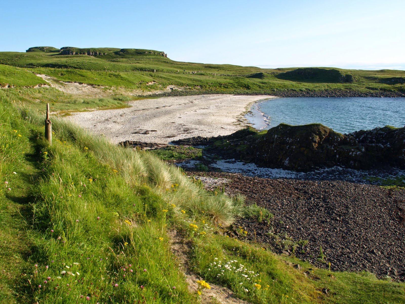
A little later we crossed the bridge to the smaller island of Sanday, to excellent views of a white sandy beach and further west.

The foot bridge between Canna and Sanday

White sand beach on Sanday

Looking west from Sanday.

At bed time we listened to the weather forecast on VHF, and were disappointed to realise that poor weather was on the way. We were planning to have another full day to explore the Island but reluctantly we made the decision to leave in the morning and head back to the safety of Mallaig. It seemed like everyone else had the same idea, as there was only one boat in the harbour when we left the next day. We hope to return in the future to this lovely island.

Solitary boat left in Canna harbour.

Tuesday, 5 August 2014

Rum & Midges!

Seventeen nautical miles to the North West took us from Arisaig to Loch Scresort on the Isle of Rum. The day was grey with the prospect of rain.

Rum appearing through the clouds and mist.

We arrived early in the afternoon, and soon the rain came, clearing later in the evening.

Sunshine after the rain.

The following morning we went ashore and encountered the dreaded midges - clouds of them!!! Luckily, we had midge nets with us, even the locals were using them. Despite the midges we had a nice walk around a marked route.

The height of millinery fashion.

After our walk we had lunch in the community centre cafe; soup, sandwiches and cake, it just hit the spot.

View of the anchorage from the community centre cafe.